This tour combines infrastructure tourism focusing on volcanic sabo (erosion and debris-flow control) facilities with geotourism initiatives promoted by the Tokachidake Geopark Promotion Council. The program started in June, and among the two available courses, I joined the “Kamifurano Course: The Story of Debris Flows and Sabo.”
◎Tour date and time: Friday, July 18, 2025, 13:00–16:00
I created a video titled “Infrastructure & Geo Tour (Kamifurano Course)”—please have a look.
2025.07.18 Infrastructure & Geo Tour (Kamifurano Course) | Kawatabi Hokkaido
https://www.youtube.com/watch?v=XqTHni14z6w
The Kamifurano Course visits three locations within Kamifurano Town over three hours.
@1 Ryounkaku Terrace
@2 Kamifurano Town Local History Museum
@3 Furano River No. 2 Slit-type Sabo Dam
 Our guide for the day was Ms. Sasaki, a certified Tokachidake Geopark guide. She also guides the “Biei Town Miyu Bus,” provides in-house guidance at the Tokachidake Volcanic Sabo Information Center, and in winter leads snowshoe trekking tours to the Nukkakushi Crater. She clearly knows the attractions of Biei and Kamifurano inside and out.
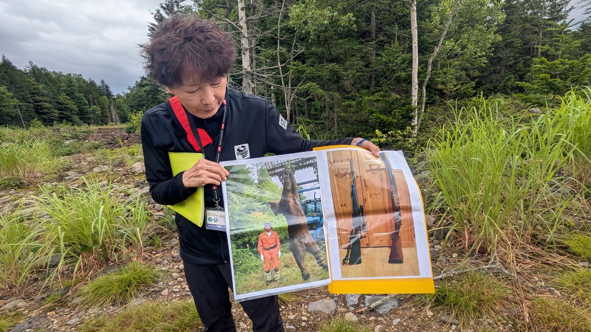
As if that weren’t impressive enough, she is also a licensed hunter. The photo above shows a brown bear he hunted. Her story about becoming a hunter was fascinating and sparked a lively discussion.
She mentioned that she is currently extremely busy preparing for the 15th Japanese Geopark National Conference (Tokachidake Conference) to be held in September.
1 Ryounkaku Terrace
 Our first stop was Ryounkaku Terrace, located in the Tokachidake Onsen area, one of the “Eight Scenic Views of Kamifurano.” The area outlined in red marks the terrace of the lodging facility Yumoto Ryounkaku.
-S.jpg) From the terrace, we could see the Nukkakushi-Furanui River flowing below. The mountain on the left is Sandanyama, and the sharp peak on the right is Bakemono-iwa (Monster Rock). The pale-colored area between them is a sabo dam, and upstream lies the Nukkakushi Crater.
From the terrace, we could see the Nukkakushi-Furanui River flowing below. The mountain on the left is Sandanyama, and the sharp peak on the right is Bakemono-iwa (Monster Rock). The pale-colored area between them is a sabo dam, and upstream lies the Nukkakushi Crater.
Here, Ms. Sasaki explained the fragility of the volcanic rock, the numerous sabo dams along the Furano River, the three nearby hot spring areas (Tokachidake Onsen, Fukiage Onsen, and Shirogane Onsen), the origins of the hot springs, and the relationship between volcanic activity and hot spring changes—an especially engaging discussion.
2 Kamifurano Town Local History Museum
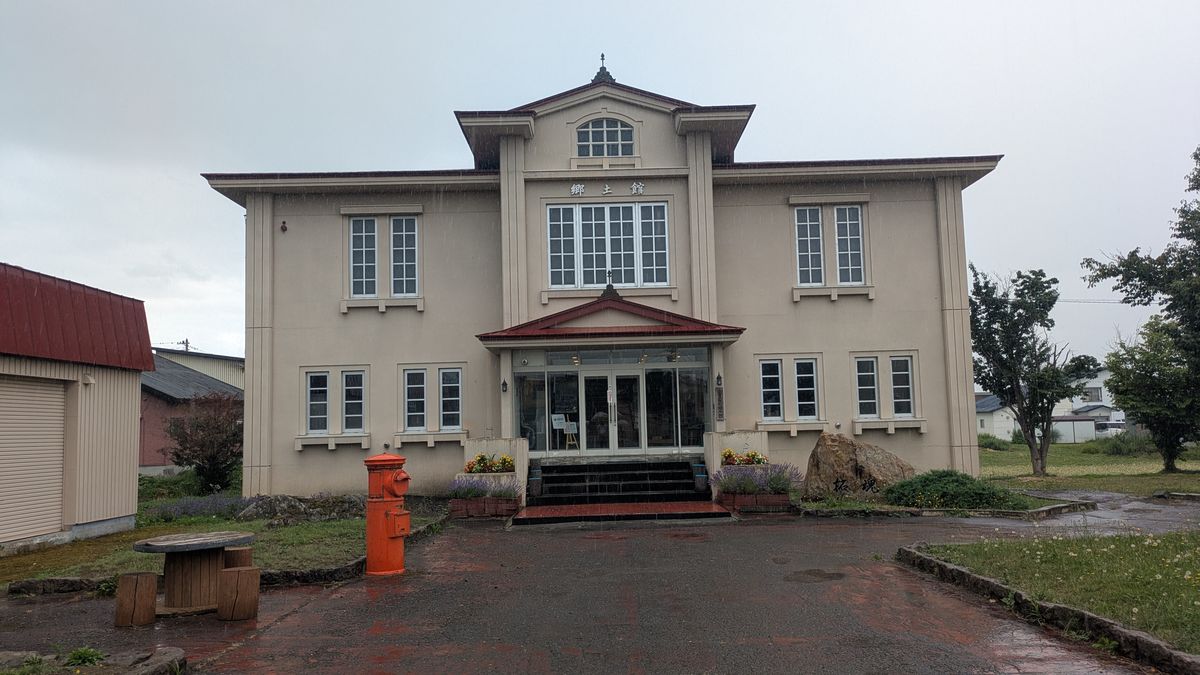 Next, we visited the Kamifurano Town Local History Museum, whose exterior resembles the former town hall.
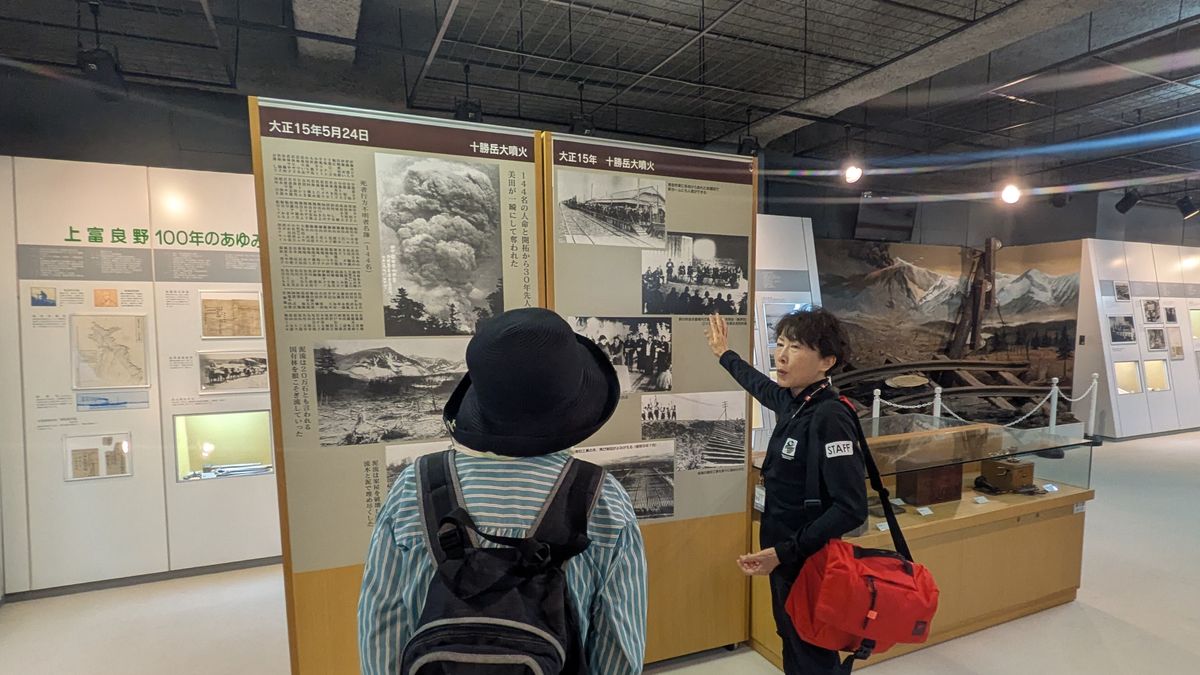 In the section on the Great Tokachidake Eruption of May 24, 1926, we received detailed explanations. Inside the museum, twisted railway rails damaged by the Taishō debris flow are on display, along with records of eruptions in 1962 and 1988. We also watched archival footage documenting the disaster and the recovery process after the 1926 eruption—highly recommended.
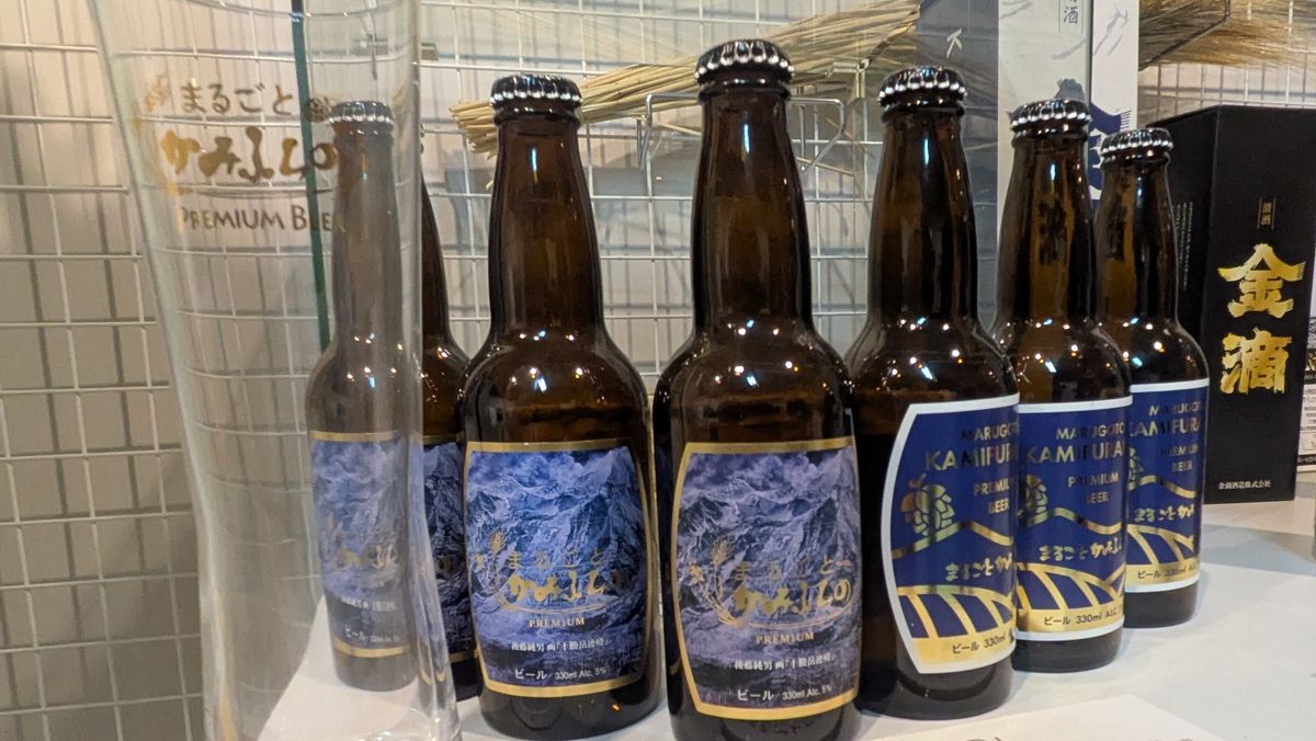 Noticing beer on display, I asked Ms. Sasaki about it. Kamifurano has long cultivated hops and malting barley, and the beer is called “Marugoto Kamifurano.” It is said to have a fruity flavor. I recalled having tried “Sorachi Ace” before, and after checking, found that it is indeed named after a hop variety produced in Kamifurano.
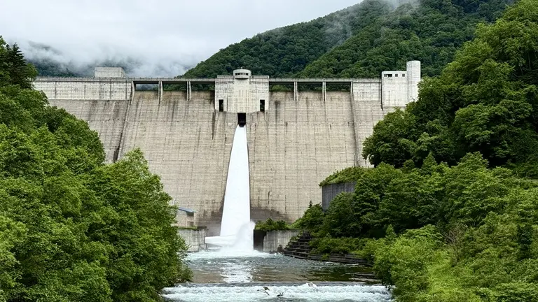
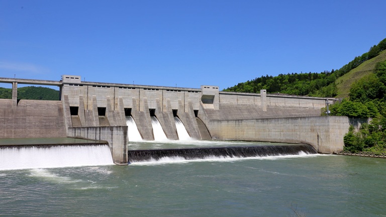
3 Furano River No. 2 Slit-type Sabo Dam
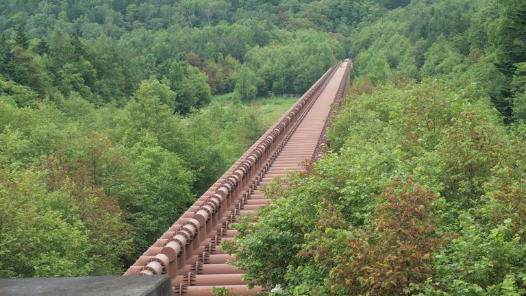
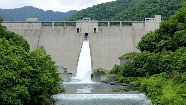
 Leaving the museum, we arrived at the highlight of the day: the Furano River No. 2 Slit-type Sabo Dam. It was astonishing to see such a massive structure deep in the mountains. The photo shows the downstream face toward the right bank.
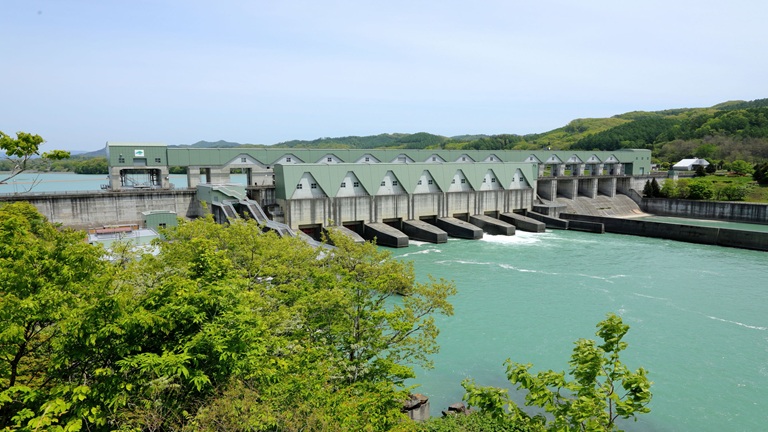
 This view shows the downstream face toward the left bank. The total length is 917 meters, and the end is barely visible. During the 1926 eruption, debris flows reportedly filled the entire width of this area.
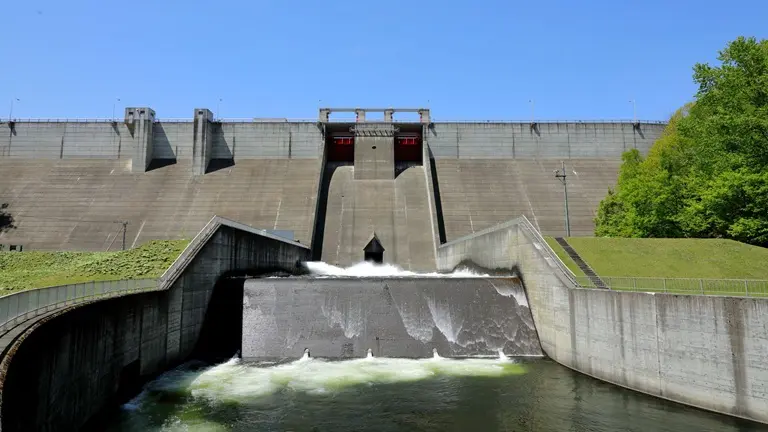
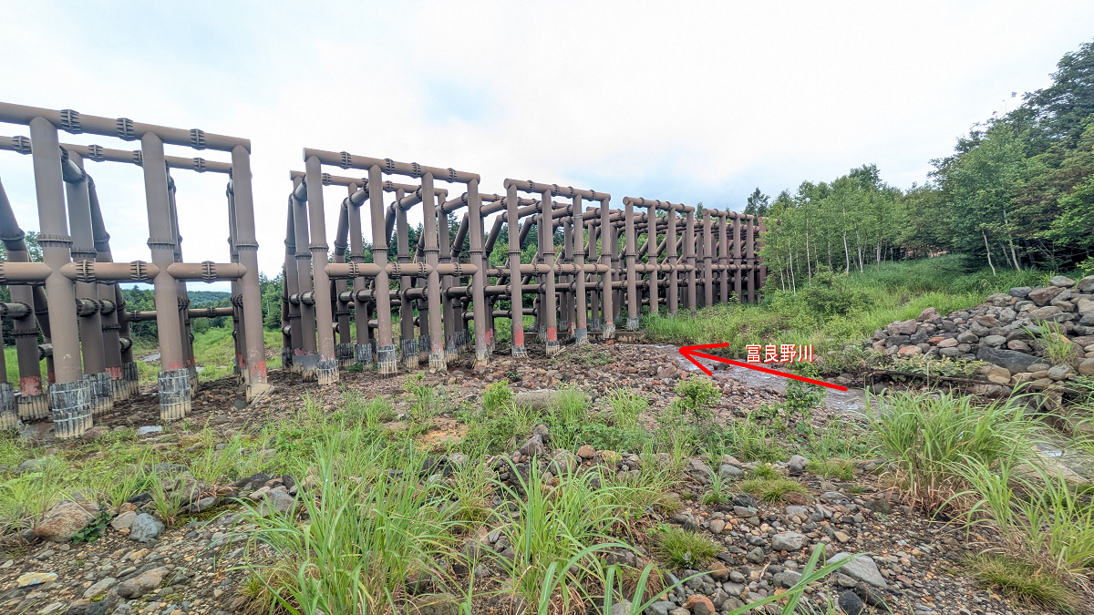 We approached the point where the Furano River flows.
The slit-type dam is constructed from steel pipes with a diameter of 60 cm. Ms. Sasaki asked us how much steel was used. None of us could guess. The answer: about the same as the Tokyo Tower—approximately 3,801 tons. Even then, it was hard to fully grasp the scale.
 When Ms. Sasaki suggested walking to the end of the dam, I momentarily felt discouraged—until he clarified we would drive.
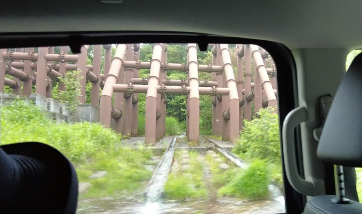 Fortunately, the water level was low enough that day to cross three small streams by vehicle.
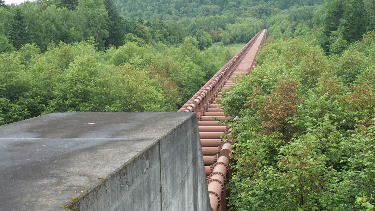 We reached the left-bank end of the dam. Seeing its full length up close was impressive. Since this area is normally inaccessible, many people may not realize how such facilities quietly protect communities downstream.
The tour was filled not only with geological insights but also many fascinating stories about Kamifurano, making the three hours pass quickly. Being able to visit normally off-limits facilities with a knowledgeable guide made this a tour I would highly recommend to many others.
Applications: Infrastructure & Geo Tour (Kamifurano Course / Biei Course) → Here
◆Related: [Kawatabi Movie・Photo Report]Joined the Infrastructure & Geo Tour (Biei Course) → Here
Meeting/Dismissal Point: Tokachidake Onsen Parking Lot
Map Code: 901 872 349*53
